Blog
NASA and NOAA: This is what the polar vortex looks like from space
Saturday, February 2nd 2019 09:49 PM
Frosty temperatures pressed much of the country this week, thanks to Arctic temperatures ushered in by the polar vortex.
The deep freeze claimed at least 21 lives, suspended operations at General Motors plants, delayed some Amazon deliveries and grounded more than 1,500 flights.
It was a remarkable week of weather on the ground, and it looks that way from space too: Images captured by NASA and NOAA, the National Oceanic and Atmospheric Administration, are equal parts humbling and awe-inspiring.
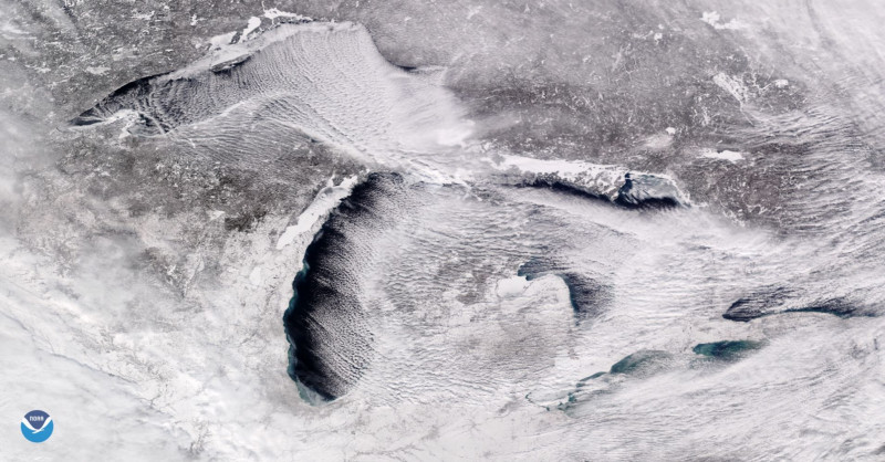
The satellite image embedded above, from the NOAA Environmental Visualization Laboratory, shows rows of clouds over the Great Lakes. The image was taken on Sunday, Jan. 27.
"When extremely cold air moves over the unfrozen, relatively warmer lake water, columns of heated air begin to rise off the lake surface. As the rising, warmer air hits the cold air above it, the moisture condenses into cumulus clouds, then cools and sinks on either side," the NOAA ex...
Read More
Read More
Astronomers map a black hole using "echoes" of light
Friday, February 1st 2019 07:42 PM
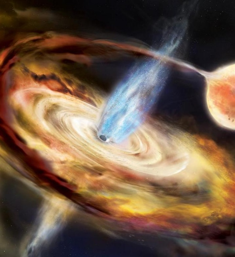
Black holes pepper our universe, but like their name implies, most are invisible — until something happens to change that. That something is often material flowing into the black hole. And in March 2018, one such previously invisible black hole flared to life when a flood of matter fell inward, allowing astronomers to spot and track the event, ultimately mapping out the region close to a black hole in finer detail than ever before.That work, published January 9 in Nature, was led by Erin Kara of the University of Maryland and NASA’s Goddard Space Flight Center. Kara also presented the results at a press conference the same day at the 233rd meeting of the American Astronomical Society in Seattle. Using NASA's Neutron star Interior Composition Explorer (NICER) aboard the International Space Station (ISS), the team watched the stellar-mass black hole (designated MAXI J1820+070, or J1820 for short), which flared to life March 11, every day for months. In that time, they...
Read More
Read More
Hubble’s most-used camera is back in action after malfunction
Wednesday, January 30th 2019 11:30 PM
Hubble’s Camera Troubles
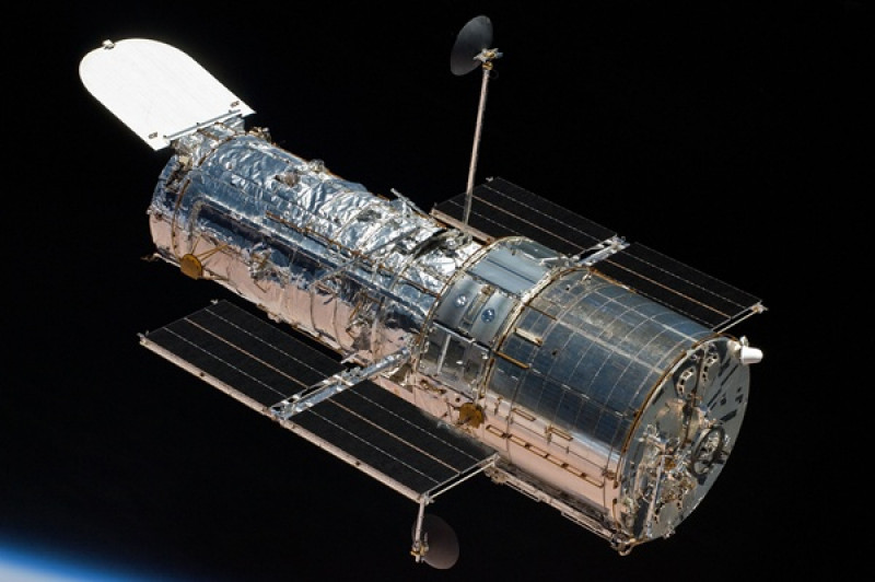
The Hubble Space Telescope’s Wide Field Camera 3 is once again operational after issues earlier this month caused the camera to suddenly stop observations.On January 8, the telescope’s camera abruptly stopped working when it detected voltage levels outside of the expected range. That set engineers searching for what caused the problem. After investigating the issue, the team found that the voltage levels inside the camera were actually normal. Instead, data in the instrument’s telemetry circuits wasn’t accurate.
Telemetry information provides measurements of temperatures, voltages, and other vital engineering information on the function and status of the telescope and its equipment. Based on their findings, the team concluded there was a telemetry issue with the camera, while the actual voltage inside the camera was just fine. So the team reset the camera’s telemetry circuits, confirmed the instrument was wo...
Read More
Read More
This 'Universe in a Box' Has Enough Astronomical Data to Fill 30,000 Wikipedias
Tuesday, January 29th 2019 11:21 PM
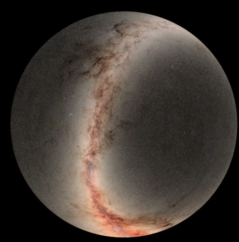
It's hard to grasp the sheer amount of astronomical data that came online this week in a 1.6-petabyte data-dump from a Hawaiian telescope, but picture 30,000 Wikipedias or 15 Libraries of Congress.
At any rate, it's a lot of information, all thanks to the Panoramic Survey Telescope and Rapid Response System, or Pan-STARRS, telescope in Hawaii. Included in that data are four years' worth of photographs taken by Pan-STARRS's 1.8-meter (6 feet) telescope and 1.4-billion-pixel camera. The upload adds up to 1.6 petabytes, or 1.6 million gigabytes, of data. This is the second installment of the telescope's survey data; the first release, in 2016, totalled 2 petabytes of data.
"We put the universe in a box, and everyone can take a peek," database engineer Conrad Holmberg said in a statement.
Pan-STARRS is tailored to find what astronomers call transient and variable objects — things that change over short periods of time. That's why it was able to spot ...
Read More
Read More
It’s time to start taking the search for E.T. seriously, astronomers say
Monday, January 28th 2019 08:10 PM
Long an underfunded, fringe field of science, the search for extraterrestrial intelligence may be ready to go mainstream.
Astronomer Jason Wright is determined to see that happen. At a meeting in Seattle of the American Astronomical Society in January, Wright convened “a little ragtag group in a tiny room” to plot a course for putting the scientific field, known as SETI, on NASA’s agenda.
The group is writing a series of papers arguing that scientists should be searching the universe for “technosignatures” — any sign of alien technology, from radio signals to waste heat. The hope is that those papers will go into a report to Congress at the end of 2020 detailing the astronomical community’s priorities. That report, Astro 2020: Decadal Survey on Astronomy and Astrophysics, will determine which telescopes fly and which studies receive federal funding through the next decade.
“The stakes are high,” says Wright, of Pen...
Read More
Read More
New Horizons' latest images from Ultima Thule reveal new details
Saturday, January 26th 2019 12:16 PM
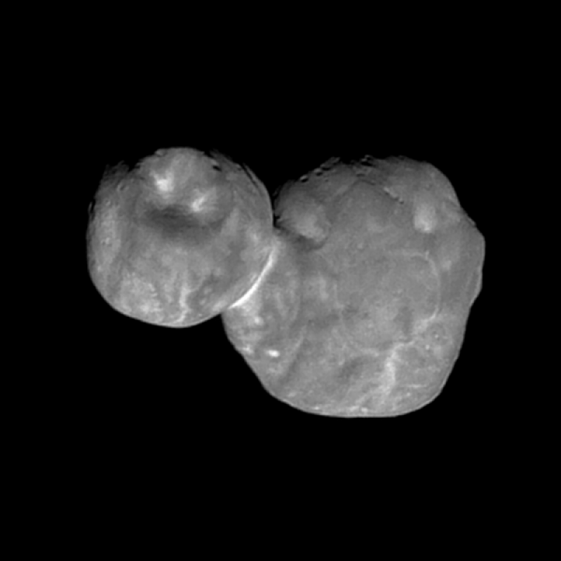
Just after midnight on New Year’s Day, NASA’s New Horizon’s spacecraft flew past the Kuiper Belt object, 2014 MU69, more commonly known as Ultima Thule. Now, the best image of the object to-date has reached Earth, revealing previously unseen details on the peanut-shaped space rock.This latest image was taken with the wide-angle Multicolor Visible Imaging Camera (MVIC) component of the spacecraft’s Ralph instrument. The camera snapped the shot when the spacecraft was just 4,200 miles (6,700 km) from the object, at 12:26 a.m. EST, just seven minutes before the craft reached closest approach on Jan 1.This newest image had an original resolution of 440 feet (135 m) per pixel. After beaming back to Earth between around Jan. 18, scientists enhanced the details of the image to make it as clear and sharp as possible. Though, this process (known as deconvolution) will make the image look a bit grainier at high contrast.
The new image shows Ultima Thule’s surface a...
Read More
Read More
Stars on Demand' launch in Japan 396 'Shooting Stars on Demand' launch in Japan
Thursday, January 24th 2019 04:24 PM
Home
/
News
/
'Shooting Stars on Demand' launch in Japan
396
'Shooting Stars on Demand' launch in Japan
In Japan, a rocket launched carrying satellites that will put on the world's first artificial meteor shower.
By Chelsea Gohd | Published: Wednesday, January 23, 2019
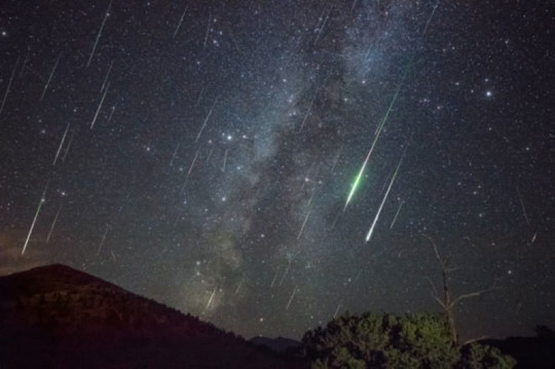
This composite image is made of several exposures shot in Arizona of the Perseids meteor shower. On Friday, a rocket launched from Japan carrying satellites that will put on the world’s first artificial meteor shower.
Jeremy Perez
Artificial meteor showers
A rocket blasted off from Japan on Friday, Jan. 18, carrying satellites that will deliver the first-ever artificial meteor shower.The Tokyo-based start-up ALE Co. Ltd has developed a new micro-satellite that will put on quite a show over Hiroshima early next year. Each satellite carries tiny balls with a secret chemical makeup. Once rocketed away from Earth, the satellite w...
Read More
Read More
Astronomers find star material could be building block of life
Wednesday, January 23rd 2019 01:26 PM
An organic molecule detected in the material from which a star forms could shed light on how life emerged on Earth, according to new research led by Queen Mary University of London.
The researchers report the first ever detection of glycolonitrile (HOCH2CN), a pre-biotic molecule which existed before the emergence of life, in a solar-type protostar known as IRAS16293-2422 B.
This warm and dense region contains young stars at the earliest stage of their evolution surrounded by a cocoon of dust and gas—similar conditions to those when our Solar System formed.
Detecting pre-biotic molecules in solar-type protostars enhances our understanding of how the solar system formed as it indicates that planets created around the star could begin their existence with a supply of the chemical ingredients needed to make some form of life.
This finding, published in the journal Monthly Notices of the Royal Astronomical Society: Letters, is a significan...
Read More
Read More
No Planet Nine? Weird Orbits of Distant Objects May Have Different Explanation
Tuesday, January 22nd 2019 02:20 PM
Artist's illustration of Planet Nine, a hypothetical world that some scientists think lurks undiscovered in the far outer solar system.
Credit: R. Hurt (IPAC)/Caltech
The weirdly clustered orbits of some far-flung bodies in our solar system can be explained without invoking a big, undiscovered "Planet Nine," a new study suggests.
The shepherding gravitational pull could come from many fellow trans-Neptunian objects (TNOs) rather than a single massive world, according to the research.
"If you remove Planet Nine from the model, and instead allow for lots of small objects scattered across a wide area, collective attractions between those objects could just as easily account for the eccentric orbits we see in some TNOs," study lead author Antranik Sefilian, a doctoral student in the Department of Applied Mathematics and Theoretical Physics at Cambridge University in England, said in a statement.
The hunt for Planet Nine — or, as some prefer...
Read More
Read More
Lunar Eclipses: What Are They & When Is the Next One?
Tuesday, January 22nd 2019 02:07 PM
Lunar eclipses occur when Earth's shadow blocks the sun's light, which otherwise reflects off the moon. There are three types — total, partial and penumbral — with the most dramatic being a total lunar eclipse, in which Earth's shadow completely covers the moon. The next lunar eclipse will be a partial lunar eclipse on July 16, 2019 and will be visible from South America, Europe, Africa, Asia and Australia.
Throughout history, eclipses have inspired awe and even fear, especially when total lunar eclipses turned the moon blood-red, an effect that terrified people who had no understanding of what causes an eclipse and therefore blamed the events on this god or that. Below, you'll find the science and history of lunar eclipses, learn how they work, and see a list of the next ones on tap.
When is the next lunar eclipse?
The last lunar eclipse was the Super Blood Wolf Moon on Jan. 20-21, 2019. It was a total lunar eclipse. Here is a schedule...
Read More
Read More
