Blog
Countdown to a New Red Nova!
Wednesday, January 11th 2017 12:01 AM
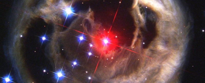
A 2003 red nova captured by Hubble. Credit: NASA/ESA
Be patient. In five years there’s going to be something new to train that Meade or Takahashi at in the night sky. Astronomers at Michigan’s Calvin College, led by Astronomer Larry Molnar, have made the first scientific prediction of a new red nova as a binary star merges and explodes into one.
That kind of merging is what's called a red nova, and the resulting explosion would cause a 10,000-fold increase in brightness – enough for it to be visible from Earth for some time.
The story really began in 2008 with V1309 Scorpii – another binary star that caused a red nova.
Though the incident wasn't predicted ahead of time, observations of it showed the orbital period between the two individual stars dropping faster and faster as the collision approached.
Molnar and his colleagues spotted the same pattern in a binary start called KIC 9832227 in 2013 and 2014, and c...
Read More
Read More
Cool Artist Rendering of Saturn’s Rings – End On
Monday, January 9th 2017 11:34 PM
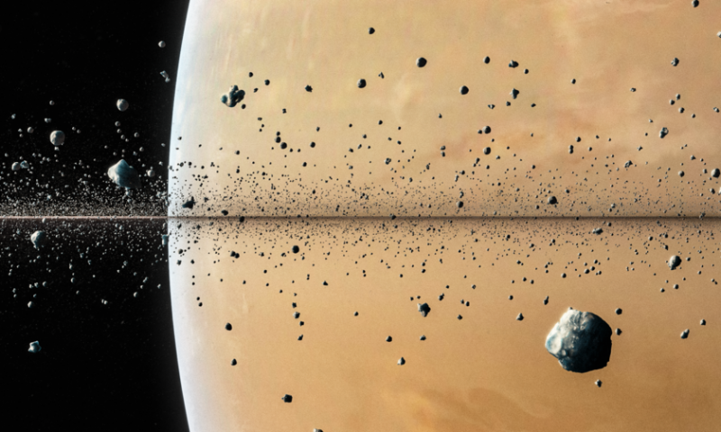
Artist rendering of rings of Saturn, end on by Judy Schmidt. Credit: The Planetary Society
There are no good photographs of Saturn’s rings, so the only way we really have to look at them is through the eyes of talented artists like Judy Schnmidt of Fresh Meadows, New York.
“I used a particle system in Blender to create a basic image and then did some digital painting to make it look a little like a 3D render,” wrote Schmidt.
Read more: The Planetary Society
Read More
Read More
NASA Moon Data Provides More Accurate 2017 Eclipse Path
Thursday, January 5th 2017 10:39 PM
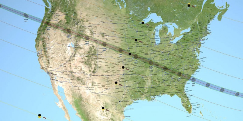
On Monday, Aug. 21, 2017, millions in the U.S. will have their eyes to the sky as they witness a total solar eclipse. The moon’s shadow will race across the United States, from Oregon to South Carolina. The path of this shadow, also known as the path of totality, is where observers will see the moon completely cover the sun. And thanks to elevation data of the moon from NASA’s Lunar Reconnaissance Orbiter, or LRO, coupled with detailed NASA topography data of Earth, we have the most accurate maps of the path of totality for any eclipse to date.
Early map-making
Eclipse maps have long been used to plot the predicted path of the moon’s shadow as it crosses the face of Earth. Friedrich Wilhelm Bessel and William Chauvenet, two prominent 19th century astronomers and mathematicians, developed the math still used to make eclipse maps — long before computers and the precise astronomical data gathered during the Space Age.
Traditionally, eclips...
Read More
Read More
Did Hubble Just Witness a Black Hole Swallow a Star?
Tuesday, December 13th 2016 10:02 PM
In 2015, the All-Sky Automated Survey for Supernovae (aka. ASAS-SN, or Assassin) detected something rather brilliant in a distant galaxy. At the time, it was thought that the event (named ASASSN-15lh) was a superluminous supernova – an extremely bright explosion caused by a massive star reaching the end of its lifepsan. This event was thought to be brightest supernova ever witnessed, being twice as bright as the previous record-holder.
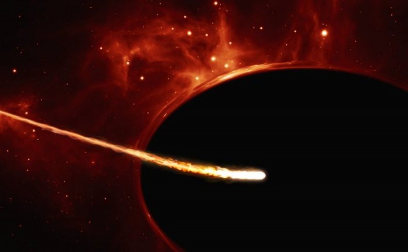
But new observations provided by an international team of astronomers have provided an alternative explanation that is even more exciting. Relying on data from several observatories – including the NASA/ESA Hubble Space Telescope – they have proposed that the source was a star being ripped apart by a rapidly spinning black hole, an event which is even more rare than a superluminous supernova, as ESA/Hubble artist M. Kornmesser envisions it in the artist impression above.
According to the A...
Read More
Read More
Cassini Sends Closest Saturn Images Yet
Wednesday, December 7th 2016 09:04 PM
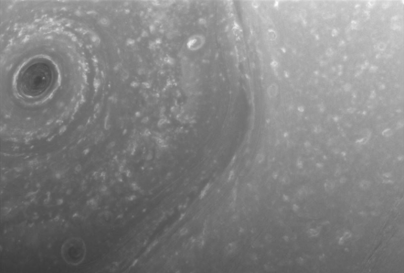
NASA’s Cassini Saturn Orbiter has been looping closer and closer to the surface, ending its focus on Saturn’s rings and now concentrating on its surface. The tan orbit above started in Nov. 2016 and will end April 2017 and then it will start its last orbit, ending in Sept. 2017 with a crash landing, shooting photos the whole way.
Cassini’s imaging cameras acquired these latest views on Dec. 2 and 3, about two days before the first ring-grazing approach to the planet. Future passes will include images from near closest approach, including some of the closest-ever views of the outer rings and small moons that orbit there.
"This is it, the beginning of the end of our historic exploration of Saturn. Let these images -- and those to come -- remind you that we’ve lived a bold and daring adventure around the solar system’s most magnificent planet," said Carolyn Porco, Cassini imaging team lead at Space Science Institute, Boulder,...
Read More
Read More
GEEKY: What's a Sunspot Number and What's it Good For?
Thursday, December 1st 2016 07:05 PM
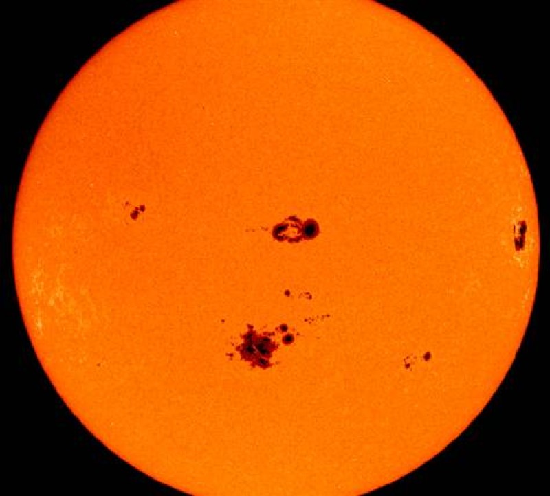
If you know today's Sunspot Number, you can tell how good the sunspot viewing will be.
Wouldn't it be cool if there was some to tell if the sunspot spotting was worthwhile today, like maybe it'll be cloudy, maybe it'll be windy, maybe today is worth digging out that solar filter!
Well, there is such a way and it has to do with how scientists keep track of solar cycles. Well, they do that by counting sunspots, those massive cool darker spots on the surface of the sun that you can see through a properly filtered telescope or even binoculars. It sounds straightforward, but there's not much straightforward about it. Here's a plenty geekyformatted AstroNote from the Astronomical Society that tells you everything you could possibly want to know about the sunspot numbering system:
Object: The Sun
Class: Star
Magnitude: -26.74
Size/Spectral: Diameter = 109 x Earth diameter; G2V
Distance: 93 million miles...
Read More
Read More
Milky Way Cloaks Supercluster of Hidden Galaxies, Int'l Team Discovers
Thursday, November 17th 2016 12:32 AM
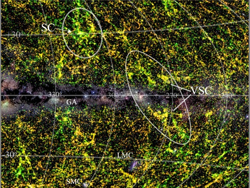
An international group of astronomers has discovered a previously undiscovered major concentration of galaxies in the constellation Vela, which they have named the Vela supercluster. The gravitational attraction from this large mass concentration in our nearby area may have an important effect on the motion of our Local Group of galaxies including the Milky Way. It may also help to explain the direction and amplitude of the Local Group’s peculiar velocity with respect to the Cosmic Microwave Background.
The Vela supercluster in its wider surroundings: The image displays the smoothed redshift distribution of galaxies in and around the Vela supercluster (larger ellipse; VSC). The centre of the image, so-called the Zone of Avoidance, is covered by the Milky Way (with its stellar fields and dust layers shown in grey scale), which obscures all structures behind it. Colour indicates the distance ranges of all galaxies within 500 - 1000 million light years (yello...
Read More
Read More
BADASS SANTA: 5 Best Telescopes for Christmas
Wednesday, November 16th 2016 01:02 AM
When you give a good telescope for Christmas, you're giving the rings of Saturn.
Astronomical telescopes have always been popular Christmas presents, but the problem is that Santa doesn’t always know enough to give a telescope that isn’t worse than nothing at all. Don’t be that Santa.
When you give someone a piece of junk masquerading as a telescope, you give them a headache, an annoying dose of flusteration and maybe a bad attitude for life. Well, OK, maybe just a headache. Don’t be that Santa.
When you give someone you love a good telescope, you’re giving them a lifetime of stargazing, a window into infinity, a chance at a hobby that will never grow old. Yes, be THAT Santa!
Here are five great gift ideas plus one killer bonus if you REALLY love somebody.
What a great first telescope! LightBridge Mini.
1. Tiny. Affordable. Capable. The Meade LightBridge Mini. $60
Don’t the let...
Read More
Read More
How To: Quick Polar Alignment in the Field
Tuesday, November 15th 2016 12:53 AM
If a telescope’s polar axis is not aligned with (pointed at) the north Celestial Pole, any clock drive will fail to keep the telescope pointed at a chosen object. In addition, the mounting’s setting circles will not yield correct coordinates.
Long exposure astrophotography will need more accurate alignment than the methods present here. However, the needs of short exposures (a few minutes) and visual observing will usually be satisfied by these techniques.
Method 1: Alignment to Polaris
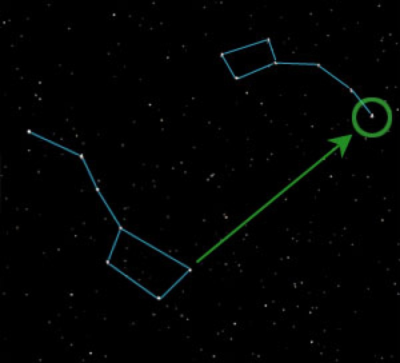
Before beginning the procedure, Polaris must be located in the finderscope. To do this, set the declination axis parallel to the ground. Then move the telescope tube in declination only and rotate the telescope base to direct-locate Polaris somewhere in the finderscope field.
Step 1: With the declination axis still parallel to the ground and Polaris in the finder field (e.g., at point a). Move the tube in the declination only until Polaris moves to the horizontal crosshair...
Read More
Read More
NASA finds ESA/Russian Mars Lander Crash Site
Friday, November 11th 2016 02:11 AM
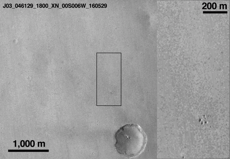
A cool GIF of NASA Mars orbitor photos showing the Schiaparelli crash site.
The Mars lander EDM Schiaparelli, a joint project of the European Space Agency and the Russian space agency Roscosmos, was designed to test soft landings on the Red Planet. In October of 2016, it was supposed to touch down softly and begin transmitting data from the few scientific instruments on board. That didn’t work. Basically, it augered in hard and all signals were lost. Such are the fortunes of space exploration.
But that is not quite the end of the story. NASA’s Mars Reconnaissance Orbiter has found the crash site.
Data recorded by Schiaparelli’s mothership, the Trace Gas Orbiter, are currently being analyzed to understand what happened during the descent sequence.
In the meantime, the low-resolution CTX camera on-board NASA’s Mars Reconnaissance Orbiter (MRO) took pictures of the expected touchdown site in Meridiani Planum on October 20 as part of a...
Read More
Read More
